

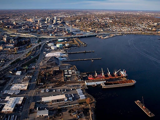
The Port of Providence is a bustling, gritty, and heavily industrialized waterfront that contains a dense concentration of major industrial tenants, scrap metal recycling, energy and petroleum infrastructure, and offshore wind projects. A stark contrast to its scenic sister shoreline India Point Park, the port’s vast asphalt footprint has long made it a focal point for environmental justice and climate resilience. As rising sea levels and intense storms threaten the shoreline and the adjacent neighborhoods of Washington Park and Lower South Providence, vital discussions are emerging to plan for a more resilient and equitable waterfront that the community can access, enjoy, and feel proud of.
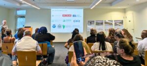
At the end of June, a collaborative network of organizations hosted a community open house at Save the Bay to share the initial results of a three-year climate resiliency project focused on Providence’s shoreline along Allens Avenue. The main groups included the City of Providence Planning Department, the Providence Resilience Partnership (PRP), the National Oceanic and Atmospheric Administration (NOAA), Groundwork Rhode Island, Save the Bay, People’s Port Authority, as well as various research, civil engineering, and architecture organizations.
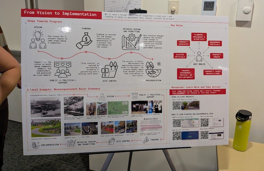
In 2022, The Providence Resilience Partnership (PRP) identified the NOAA national Climate-Ready Coasts initiative as a significant funding opportunity for the city and began mobilizing partner organizations to develop a winning proposal. In 2023, the Biden-Harris Administration awarded $492,000 in funding for the project, titled “Catalyzing Citizen Engagement in Port of Providence Climate Resilience and Habitat Restoration.” The project aimed to create a comprehensive analysis of the Port of Providence to determine improved shoreline opportunities, habitat restoration needs, and climate resilience plans while engaging local community members most impacted by the port.
“PRP recognized this grant as a unique opportunity for Providence,” said Michelle Jalbert, executive director of PRP at the June 2026 open house. “We shopped the idea around to potential partners until the City of Providence Planning Department agreed to take it up.”Jalbert commended the City’s Planning Department for advancing the project alongside PRP, keeping it on track despite administration changes at both the local and federal levels. Jalbert added, “as decisions are made about this coastline, it is critical that community members have an opportunity to be part of the process, be informed about the science, and fully understand the implications.”
The PRP brings together a broad coalition of local government, businesses, scientists, nonprofits, and community leaders to secure federal funding to prepare Providence for climate change. PRP served as a key advisor throughout the grant’s three-year engagement, also connecting the analysis to a larger citywide Climate Vulnerability Assessment and Climate Readiness Plan.
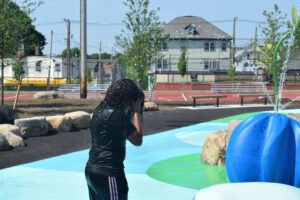
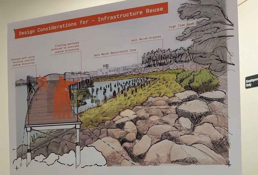
The project pairs critical climate risk data for a distressed, highly vulnerable stretch of the city with extensive community collaboration. Residents living in South Providence and Washington Park neighborhoods were invited to join monthly cohorts to learn about the data and co-create solutions for a more resilient port shoreline that spans from Sassafras Cove to Collier Point Park. The project asked residents to imagine a future they wanted to see, generating ideas that include protected biking infrastructure, restored native salt marshes, and elevated walking paths for community enjoyment of the waterfront.
At the open house, attendees moved through six stations throughout the room that mirrored the journey of the community cohorts. These exhibits ranged from an introduction to the project, to a deep dive of the history of the shoreline, and culminated in a collection of community-driven ideas and renderings of potential future projects.

While visualizing a healthy, vibrant future for heavily industrialized stretches like Allens Avenue can be challenging, the prevailing sentiment among attendees was one of optimism, excitement, and hope. For some residents, the process has successfully broken through long-standing distrust regarding planning initiatives that ask for community input. “I was initially skeptical because a lot of projects say they want resident engagement, until they start getting resident engagement,” shared Dwayne Keys, a member of the project’s first cohort. “But I have been deeply impressed. Residents aren’t just listened to, but our feedback has been reflected in the work.”
“One of the things that really stands out in this project is the high level of community engagement incorporated into this work,” said Danielle Perry, PhD, a marine habitat resource specialist at NOAA who was at the open house. “The residents all had input and insights into the designs shown around the room today.”
While the designs presented offer an exciting glimpse into the future, Dr. Perry explained that the project is still in the ideation phase. In fact, community feedback from the open house itself will be woven into the project plans. Moving from vision to reality will be complex and require navigating a multitude of factors. As previously reported byThe Providence Eye, the city does not own most of the land in the Port of Providence. “Bringing private landowners to the table as willing partners will be a key next step in this process,” said Dr. Perry.
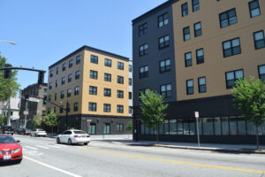
This tension between community-led planning and private landowners is exemplified by a leaking stormwater pipe at Public Street. Remediation of the pipe has stalled development of the public access site, which will include a small park with a walkway, benches, and native plants. The City of Providence has claimed that Rhode Island Energy is responsible for paying to fix the leak, and the parties are in talks to reach an agreement.
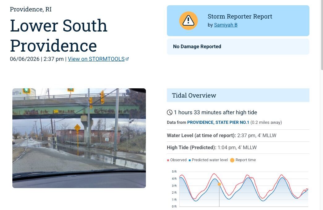
Among the open house stations dedicated to the shoreline project was a table featuring a mobile app that helps monitor climate impacts in real time. Casey Tremper, a coastal resilience specialist with Rhode Island Sea Grant, demonstrated MyCoast—an app that she developed to crowdsource photographs of localized flooding events. By linking these photos to live weather and tidal data, the app generates comprehensive reports that help planners, government entities, business owners, and residents track flooding risks and identify areas to invest in for resilience and adaptation.
Imagining the future of the Port of Providence shoreline resonates far beyond the neighborhoods in Lower South Providence. The open house drew residents from all over the city, sparking vital conversations about what is possible when local government and planners work intentionally with the community to define the future they want to see. This collective enthusiasm demonstrates widespread appetite to build a more fair and climate-resilient city that spans from the shoreline and beyond, to every neighborhood.
Want to comment? Click!